After a week by the sea in Seward, followed by a week by the sea in Homer (Ma will write more about Homer) we said goodbye to the ocean for a few months and started heading towards Denali National Park yesterday. Because we had to pass through Anchorage to get to Denali from Homer we turned the move into a combination of moving and logistics. First stop was at Costco in Anchorage to stock up on a month or two of staples (our next big city with a Costco will be Edmonton in Alberta, probably in four to six weeks). Next we stopped at an Old Navy to buy some more inexpensive clothes suitable for the outdoors for various family members. It was dinner time by the time we finished at Old Navy, so we spent the night at Eagle River Campground, just north of Anchorage, and this morning Ma is doing mutiple loads of laundry at an Eagle River laundromat while I watch the kids play in a nearby playground. Next up is a big shop at a grocery store, followed by driving up to the town of Talkeetna which is just south of Denali.
Monthly Archives: July 2014
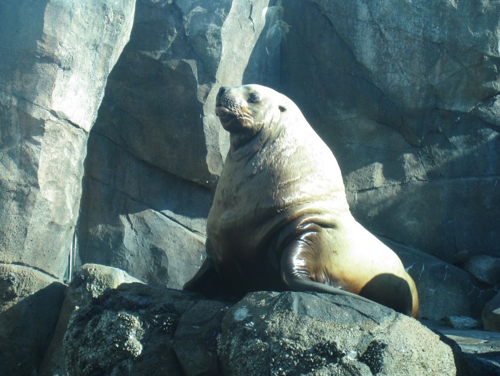
Sea Lions, Salmon, and stranded
Two days ago on our last day in Seward, we went to the Alaska Sea Life Center. We got to see the Steller Sea lion being fed. It did lots of tricks like jumping out of the water, climbing up on rocks, and lying down. The keeper had really good aim when throwing fish and the sea lion was really good catching fish. I learned that male full grown Steller sea lions can weigh from 990-2470 pounds, with the average being 1199 pounds. They are 9.3-10.7 feet long with the average being 9.8 feet long. We also saw an octopus, salmon, puffins, live barnacles, seals, and many other things. Then we got to touch some sea stars, sea urchins, hermit crabs, and anemones. One anemone grabbed me when I touched it. It was cool!
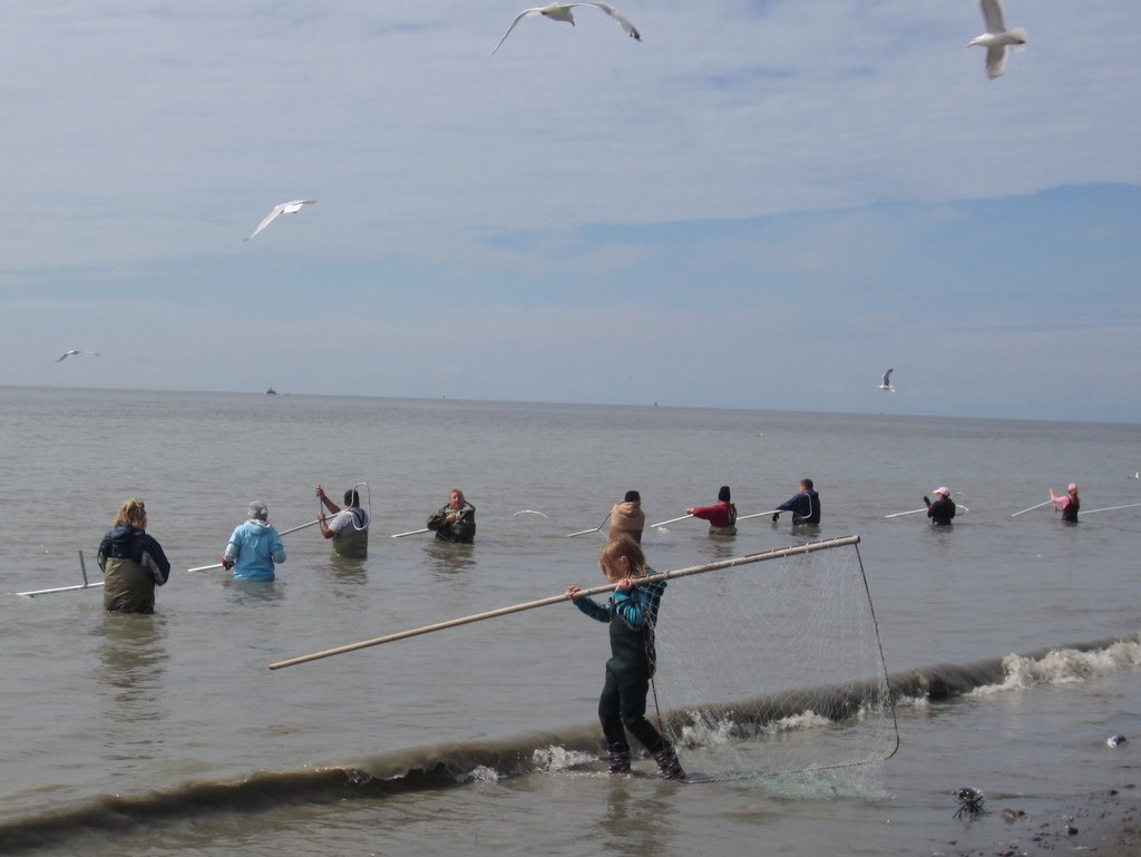
Yesterday we drove from Seward to Homer. On the way, we stopped to see the dip netting. Dip netting is where people catch salmon with big nets and long poles. You are only allowed to dip net if you have lived in Alaska for at least a year. There were so many people it was crazy. The people were chest deep in the water with their nets. The gross part was that the beach was covered with fish heads.
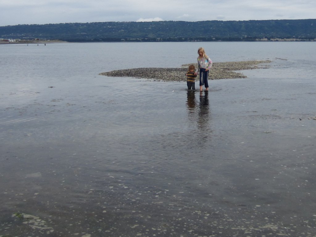
This morning we explored the tide pools at the beach. I found a bunch of little hermit crabs. Little Kid and I went on a little spit to see some jelly fish. A minute later we realized we were stranded because of the rising tide. We had to wade back. We had fun even though we got very wet.
Seward
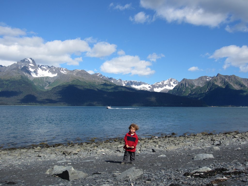
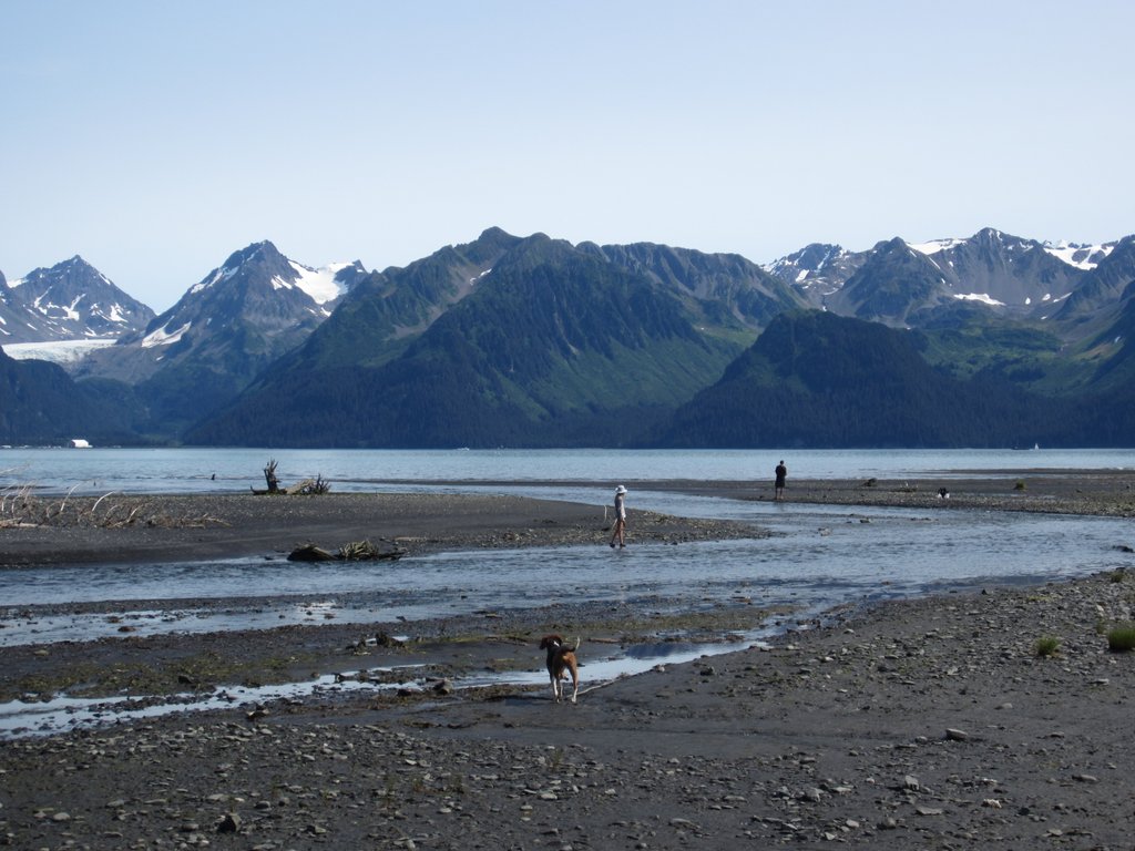
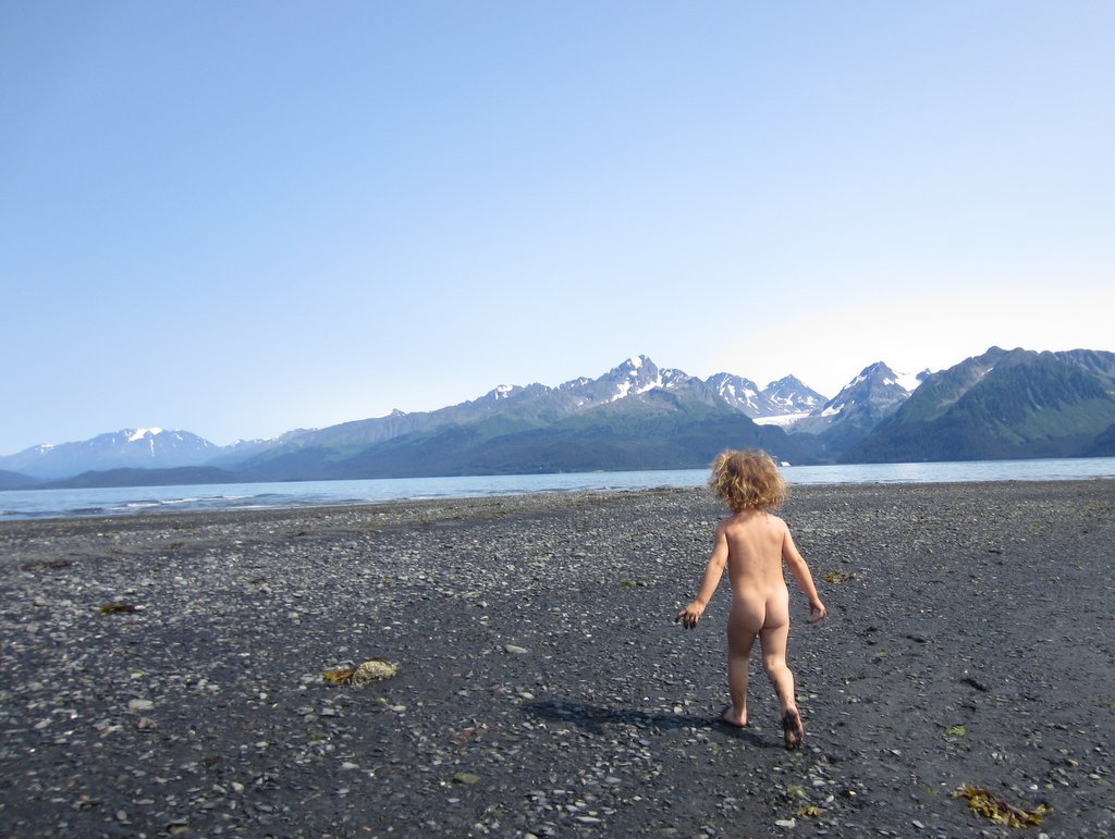
Although the campground was a little tight, the more time we spent in Seward the more it grew on us. Despite being crowded, the campground was quiet and peaceful, even with everyone hanging out outside until past 11pm in the long northern twilight. Seward has a beautiful setting; it sits on the edge of a large bay surrounded on all sides by mountains capped with snowfields and glaciers . For the kids there was a great playground adjacent to the campground and a slate beach right in front of our campsite. A paved pedestrian path runs two miles along the waterfront. On every walk along the path we saw otters and/or a bald eagles. The Seward library has the fastest public wifi in 3,000 miles by an order of magnitude or two. In Whitehorse, Skagway and Haines we got dial-up speeds, at best, on the library wifi, but in Seward the connection was often as fast as our home internet back in Tucson.
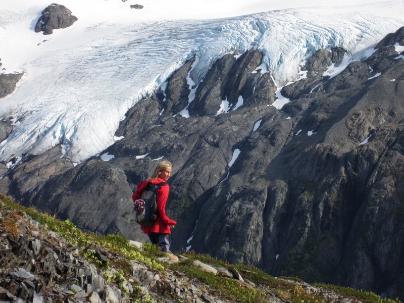
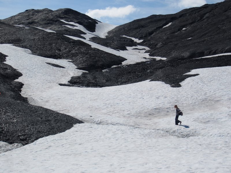
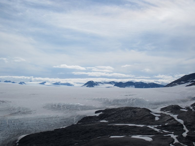
There is also some great hiking near Seward. One day Little Kid walked the entire way when the family did a two mile hike to the base of Exit Glacier in Kenai Fjords National Park. The next day Big Kid and I returned to the park and did a 9 mile (round trip) and 3,000 foot elevation gain hike up to an overlook of the Harding Icefield. The Harding Icefield is a huge (300 square miles) ice sheet left over from the last ice age that has 40 glaciers extending from its edges. The hike starts in forest near the base of Exit Glacier (so named because early explorers of the Harding Icefield used it as a way down), then climbs up through a bushy zone into alpine meadows sprinkled with flowers. Then the trail gets up into snowfields and slate scree, where we saw Dall sheep clambering on the heights above us. Big Kid really enjoyed hiking through snow in July, but my toes got a little cold in my Tevas. Finally, we crested the last rise and were looking down on the Harding Icefield, a vast expanse of snow and ice extending to the horizon with rocky mountain peaks poking through here and there. We were really lucky to have such great views of it. We met a man up there who said it was his fourth hike up the the overlook, and the first one were he could see anything besides fog and clouds.
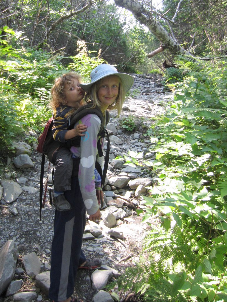
Another day the whole family did a hike out to Tonsina Point, a beautiful spot where a creek filled with spawning salmon flows into the bay. On the way back from the point Big Kid offered to carry Little Kid. We agreed, thinking that she would give up after a few minutes (Little Kid weighs 30 lbs and Big Kid weighs only 60 lbs), but Big Kid carried her brother for 1.5 miles without any problems.
On our last full day in Seward the splurged to go to the excellent Alaska Sea Life Center. The center had large aquariums with a wife variety of Alaska sea life, from King Crabs to Stellar Sea Lions and Harbor Seals. A combined aviary and aquarium allowed us to see puffins swimming underwater, and the nests of puffins and other sea birds. There was a whole section on salmon, with aquariums with salmon at all the different stages of their life cycle. The kids, and grownups especially enjoyed a tank where you can touch sea stars, anemones and crabs.
Scenes from Seward
Haines to Seward via Anchorage
I have posted anything on the blog for a couple weeks, so here is my take on where we have been since I last posted.
After spending time in Skagway and then taking the ferry (aka the Alaska Marine Highway) over to Haines and spending a few days there, we decided to make a beeline for Anchorage, 750 miles away. When we looked at the guidebooks there wasn’t a lot to see or do between Haines and Anchorage, and we were eager to get to the Kenai Peninsula, which is south of Anchorage, so it made sense to put in a few long driving days.
The first thing we did after leaving Haines was leave the United States again. Although Haines and Skagway are both in Alaska, and they are probably only about 15 miles apart as the crow flies, the only way to reach either of them by road, or even drive between them, is via Canada, so a few miles out of Haines we had to re-enter Canada in order to get to the rest of Alaska.
After over a week in Skagway and Haines, it was strange to be back in the emptiness of the Alaska Highway. Once again we were by ourselves on an empty two lane highway, with miles and miles of wilderness interrupted only by the occasional roadhouse (a roadhouse is a combo of a gas pump, cabins, restaurant and store). Probably 80% of the roadhouses were defunct or on the way to defunct. The first stage of roadhouse decline is the “for sale” sign, which almost all open roadhouses had. Then there are the recently closed ones that look like they closed in the last year or two, some of which still have an optimistic “for sale” sign. Next are the ones with broken windows and structural damage. Finally, there are full on ruins with collapsed buildings that are being reclaimed by the forest.
Between Haines Junction and the Alaska border we finally ran into truly bad road. This section of the highway is built on permafrost, and apparently roads built on permafrost don’t hold their flatness very well. We would be driving along on normal pavement, and then suddenly there would be a stretch of highway with humps and dips in it, like the pavement was an unmade bed or someone had put in unmarked speed bumps. Hitting one of these wavy sections at any speed would send everything flying in the RV, so I learned to always be looking as far ahead on the road as possible, and to slow down to about 15 mph or less to navigate the rough parts. Even with keeping a careful lookout, we had a few carnival ride experiences when we hit long slow humps that were hard to spot.
After two days of driving we finally got to the Anchorage area. After weeks weeks in the wilderness and small towns, it was like hitting the rewind button and suddenly being returned to the lower 48. Out of nowhere there were four lane highways, exit ramps, fast food restaurants, traffic lights, multiple radio stations, cell service, traffic, and big box stores. The backcountry parts of northern Canada and Alaska are in many ways unchanged from the 1940s or 50s, so coming into Anchorage felt almost like time travel.
After a provisioning and pizza run to Costco, we spent a couple days at the pleasant Eagle River Campground a few minutes north of Anchorage. While in the Anchorage area we stumbled upon the Bear Paw Festival in Eagle River, which Big Kid really enjoyed, and spent a day walking some of the 122 miles of trails in Anchorage. The trail system took us to a playground every mile or so, so the kids had a great time with that too.
Our next stop was the Williwaw Campground in the Portage Valley, about an hour south of Anchorage. The main reason for stopping there was to visit the nearby town of Whittier. Whittier is a strange place. It consists of a container port, a railroad station, a marina, and a few shops for tourists. Most of the 177 residents live in a single 14 story high rise, and there is an even bigger abandoned high rise a short distance away. The only way to reach the town by road is to go through a 2.5 mile tunnel (one of the longest tunnels in the world), and since the tunnel is one lane and shared with a railroad, cars and trucks have to wait for a 15 minute window once each hour for each direction to use the tunnel. During World War II the US Army wanted a deep water port linked to the Alaska Railroad that was closer than Seward, so they built a railroad tunnel through the mountains at the head to Portage Valley to reach the shores of Prince William Sound, where they built a port. During the Cold War the Army built a base at the port consisting of two large high rises instead of a collection of smaller buildings. They closed the base in 1960. One high rise became private condos and the other was abandoned, but never torn down, apparently because disposing of the debris would be too expensive.
After a couple hours walking around Whittier we hiked up to Portage Pass from the Whittier side of the tunnel. From the pass we had amazing views of Portage Glacier down below us, and even saw some chunks of glacier crash into the Portage Lake.
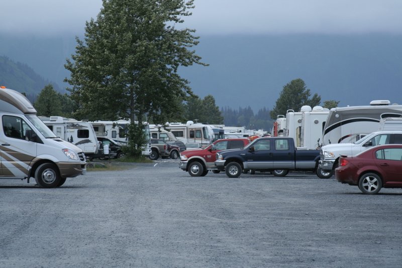
After a few days in Portage Valley it was time to move on to Seward. We were looking forward to Seward because the city had a number of campgrounds right in town and right on the waterfront. I guess we envisioned the typical government campground, with lots of space and vegetation between each space, because we were a little taken aback when we pulled up and saw that the campgrounds were a series big gravel lots along the waterfront with RVs packed in like sardines. However, we lucked out and managed to snag the space at the end of a row so that we had views of the bay out our windows instead of views of our neighbor eight feet away.